Angle and Distance / Regős Benedek
2022. 03. 22. – 04. 14.
„In a similar way, with a land surveyor you don’t walk through a countryside, rather you explore it from the point of view of the triangulation system.”
(Petr Rezek: Photographs as choreography in. Jan Svoboda: I’m Not a Photographer)
(Petr Rezek: Photographs as choreography in. Jan Svoboda: I’m Not a Photographer)
Regős Benedek Angle and Distance (Szög és távolság) I. című kiállítása – amely az azonos nevű, folyamatban lévő projektjének első itthoni bemutatkozása – a földmérés, a térképkészítés és a fotográfia természete közötti párhuzamosságok megidézésére és feltárására tesz kísérletet.
Mindig is bennünk volt a Föld felfedezésének, felmérésének, megismerésének szándéka. Hogy az egyébként nehezen rendszerezhető földfelszínt különböző geometriai struktúrákba, földrajzi hálózatokba integráljuk, amelyekben kijelölhetjük az életünkhöz szükséges referenciapontokat, határvonalakat. Ezek a rendszerek adják a keretet a terep felméréséhez is, amely során az összegyűjtött adatokat dekódolható jelekbe, (tér-)képekbe transzformáljuk, hogy így vizualizálva átfogó és áttekinthető információként segítsék és befolyásolják a mindennapos döntéseket.
Ez az absztrakciós folyamat, az absztrakt térben való gondolkodás az euklideszi geometrián alapul, amely évezredek óta meghatározója az ember világ- és térszemléletének. A szög és a távolság ennek a geometriának két alapvető mérési típusa, amelyek segítségével lehetővé válik – a háromszögelés elve alapján – egy térben elhelyezkedő tetszőleges pont koordinátáinak megadása. A háromszögelés elve (és tágabb értelemben a trigonometria) azért különösen érdekes a fotográfia kontextusában, mert mindamellett, hogy a földmérés, a geodézia (és végső soron a térképészet) alapja, egyúttal az optikai leképezésben is lényeges szerepet játszik. Az, hogy a térképekre és a fényképekre a mindennapi életben pontos és hiteles információhordozókként (akár referenciaként) támaszkodunk, lényegében keletkezésük közvetlen vagy közvetett mértani eredetére vezethető vissza.
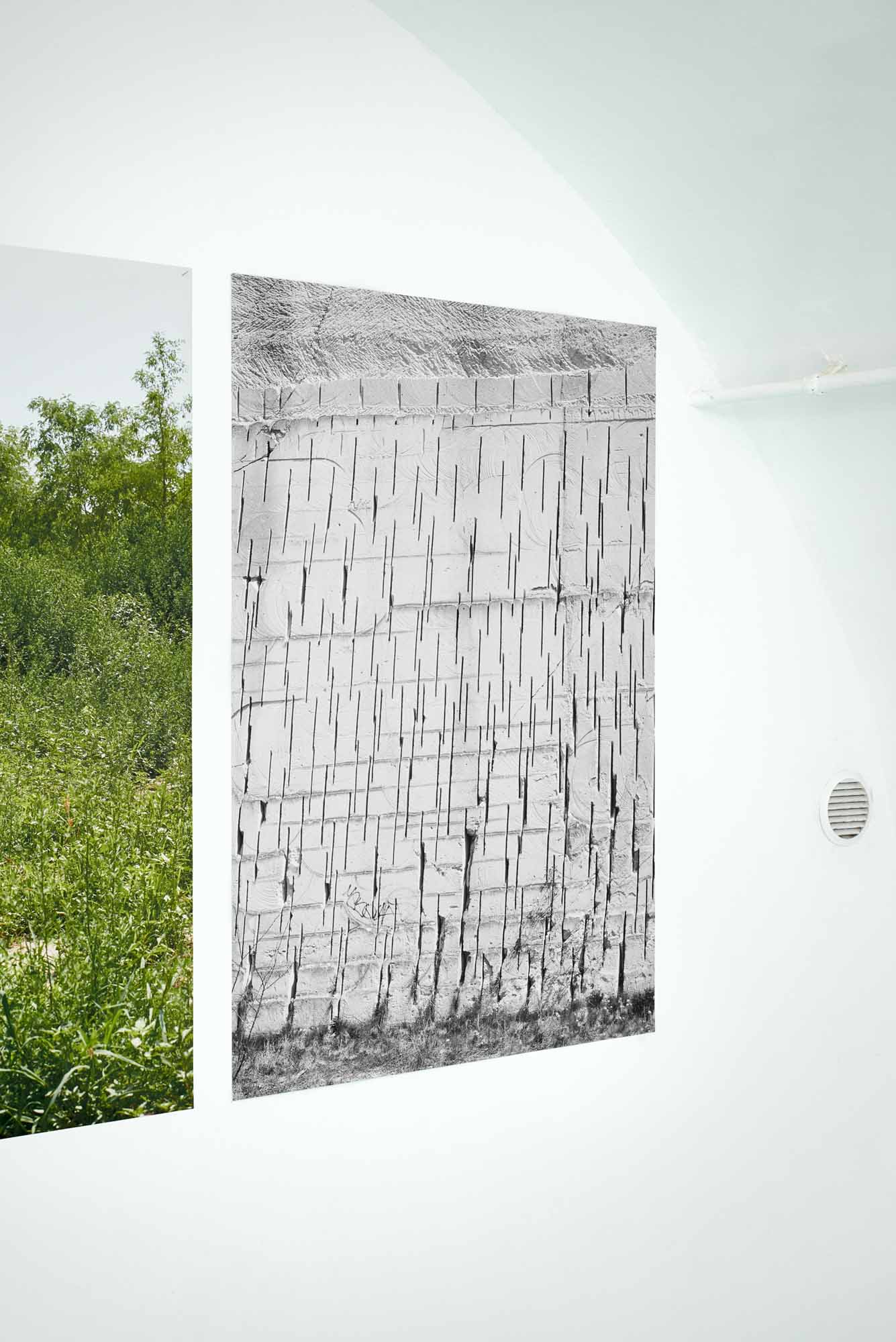
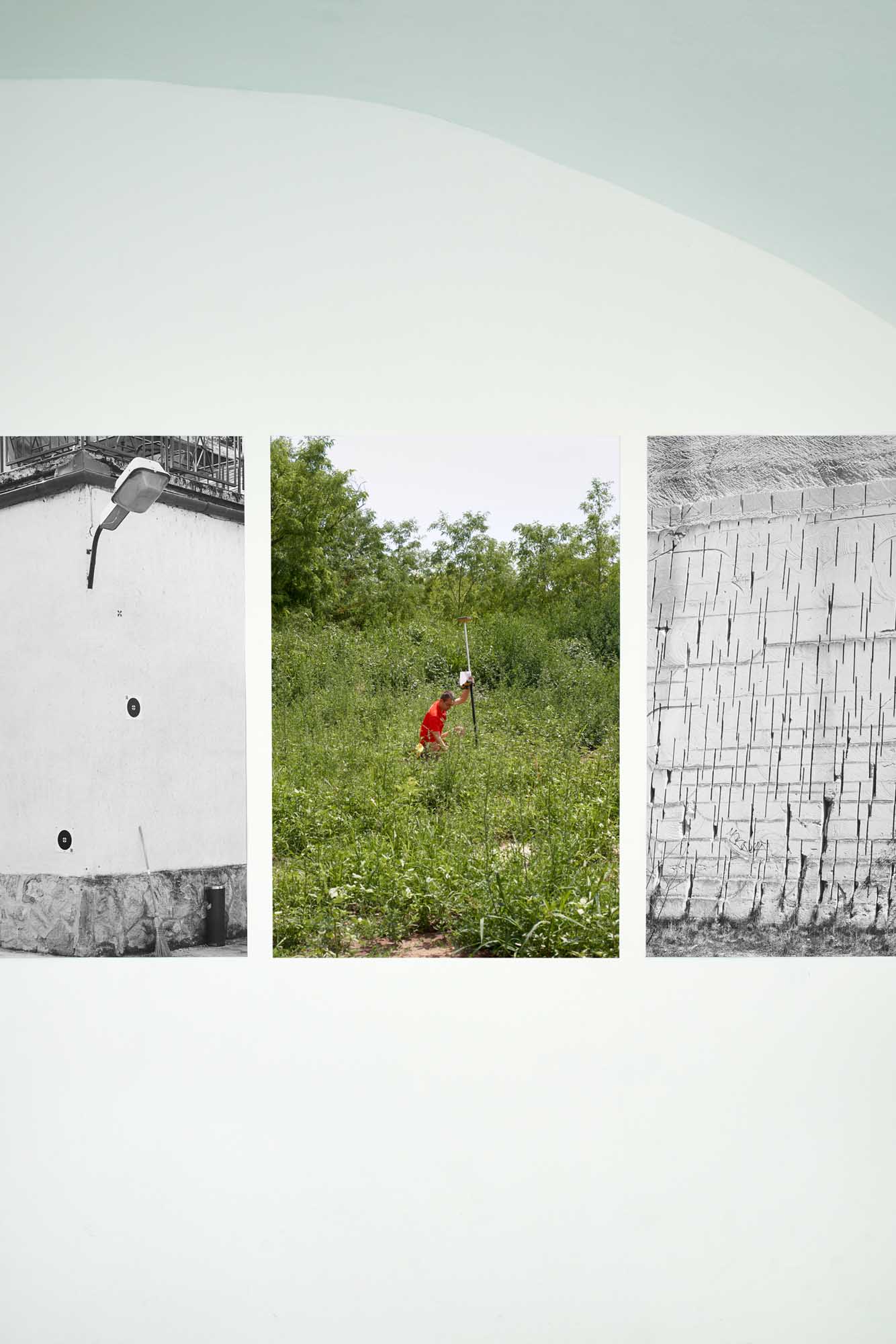
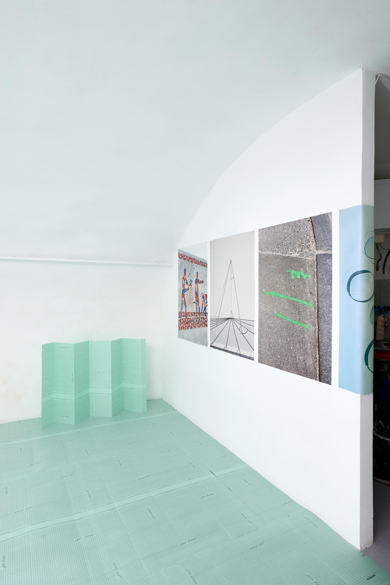
A kiállításon megjelenő képek a téma változatos aspektusait érintik. Egyrészt a terepfelmérés és a (tér-)kép alkotás munkafolyamatainak fázisaira reflektálnak (célkitűzésekre, az alkalmazott eszközökre, technológiákra, gyakorlatokra, valamint az ezeket végző személyre), másrészt a vizsgált műveletek képi eredményeire, ezek hatásmehanizmusára (az adatokat megjelenítő jelek és jelrendszerek működésére, valamint arra a paradoxonra, ami az emberi tényezőt kizáró leképezési technikák és a mögöttük rejtőző egyéni döntések között feszül).
————————————
EN
EN
„In a similar way, with a land surveyor you don’t walk through a countryside, rather you explore it from the point of view of the triangulation system.”
(Petr Rezek: Photographs as choreography in. Jan Svoboda: I’m Not a Photographer)
(Petr Rezek: Photographs as choreography in. Jan Svoboda: I’m Not a Photographer)
The ongoing work “Angle and Distance” attempts to evoke and explore the parallel motifs between surveying, mapping, and the nature of photography.
We have always had the intention to explore and survey the Earth trying to integrate it’s otherwise hardly organizable surface into different geometric structures and geographical networks in which the reference points and boundaries necessary for our lives can be designated. These systems also provide the framework of land surveying, during which the collected data is transformed into decodable visual signs and maps, so that they can help and influence everyday decisions as coherent and comprehensive information.
This process of abstraction, the thinking in abstract space, is based on Euclidean geometry, that has defined our worldview since ancient times. Angle and distance are two basic types of measurement of this geometry, that make it possible to determine the coordinates of any point in space based on the principle of triangulation. Triangulation (and trigonometry in a broader sense) is particularly interesting in the context of photography because, in addition to being the basis of surveying, geodesy (and thus cartography), it also plays an important role in optical imaging. The fact that we rely on maps and photographs as accurate and authentic source of information in everyday life is essentially due to the direct or indirect geometric nature of their origin.
The exhibited images refer to countless aspects of the topic, forming an associative system. On the one hand, they reflect on the phases of the land surveying and mapping workflows (aims, tools, technologies, practices and the person performing them), and on the other hand, on the visual output of these efforts. (How can the surveyed data be transformed into signs, sign systems, and how can we create different types of technically made images, representations that we can trust and take as a reference? Despite their appearance how do these representations relate to reality, to what extent are they based on human decisions?).